Internship project (2016)
C-Through – A Prototype for Interactive 3D Urban Planning Analysis on the Web
Technologies used
JavaScript • CityEngine • ArcGIS Pro • ArcGIS Online • ArcGIS API for JavaScript • amCharts
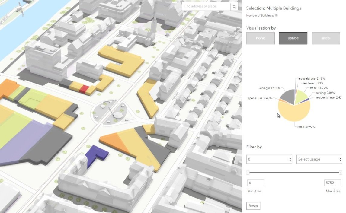
By prototyping c-through – an interactive 3D web application based on the ArcGIS JavaScript API – we are aiming to support decision making in urban planning by providing tools that help explore and analyze the implications of usage distribution on a unit scale – that is e.g., on the level of apartments, stores or offices, commonly referred to as “spaces”. The web application developed in the scope of a 3-month summer internship was implemented for three locations on different scopes: Zurich, Vancouver and Dubai.
Project Overview
more about the project
Urban planning is a challenging task, especially for extensive infrastructure and building projects in mixed-use areas where different stakeholders, needs, and interests collide. In order to resolve such tasks, urban planners all around the world are establishing the third dimension in planning processes for visualizations and data analysis. Collecting 3D datasets has become a common task for cities but sometimes the data is not presented or available in a way that urban planners can actually use it for decision making.
By prototyping c-through – an interactive 3D web application based on the ArcGIS JavaScript API – we are aiming to support decision making in urban planning by providing tools that help explore and analyze the implications of usage distribution on a unit scale – that is e.g., on the level of apartments, stores or offices, commonly referred to as “spaces”.
Learn more about this project on this ArcGIS Blogpost.
Learn how to build your own c-through by forking the code on GitHub.
interested in learning more?