Interdisciplinary project work / publications (2017, 2020)
Evaluation of Pedestrian Navigation in Smart Cities
Technologies used
C# • CityEngine • Unity • R
This project work was a collaboration between the Institute of Cartography and Geoinformation at ETH Zurich and the Department of Geography at University of California, Santa Barbara. The project addresses recent research in the area of pedestrian navigation aids that aims to find alternatives to the widely-used map-based navigation systems. The work resulted in two publications.
Project Overview
more about the project
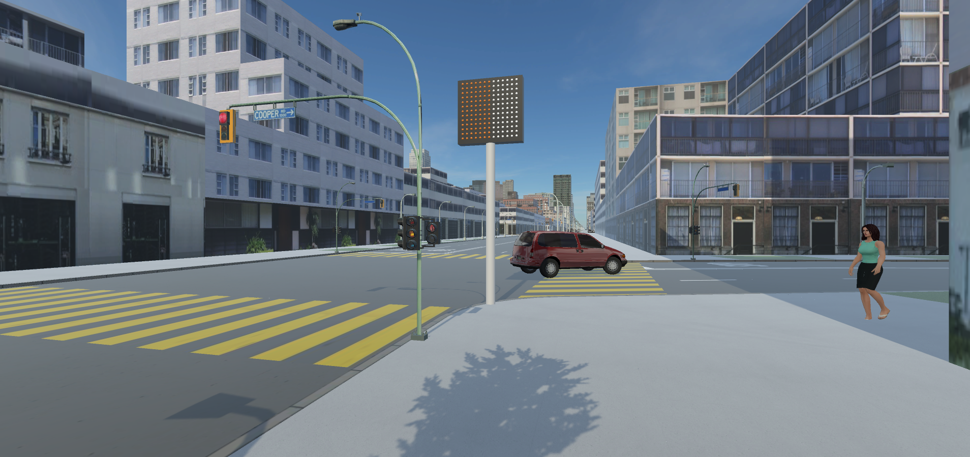
Four different approaches were compared to each other in a user experiment that was conducted in a virtual environment: (1) map-based, (2) landmark-based, (3) augmented reality, and (4) public display-based navigation where the last one is considered to be a novel approach whose performance has not yet been evaluated in a virtual environment comparison.
The Virtual Urban Environment was designed in order to reach a certain level of realism so that results are comparable with real-world experiments. The environment was created with the aid of Esri’s CityEngine, a rule-based 3D modeling software. CityEngine was utilized to draw a street network that was used to create a navigation path for the user experiment with 13 decision points of varying levels of difficulty (e.g., T-intersections vs. star intersections). The street network was enriched with realistic furniture by implementing the newest version of the Complete Street Rule. Buildings along the street were constructed in a high variety in order to create an urban setup for the user study. Additionally, the local landmarks as part of the second condition of the experiment were deployed in CityEngine by simply drawing new ground floor shapes and attaching realistic textures of shops and restaurants.
After building the skeleton of the Virtual Environment in CityEngine, the models were then exported as FBX which allows them to be imported directly in Unity3D, a Game Engine where animations and interaction with the navigation systems could be added. There, efforts were made towards a more dynamic virtual environment by implementing a traffic system featuring moving cars and pedestrians.
A user experiment was performed with 45 participants that showed partly unexpected results. The augmented reality approach performed best over a wide range of factors (efficiency, effectiveness, user experience), followed by the map-based approach that revealed similar results as the public display approach. The landmark-based approach lagged far behind compared to the other three conditions. This finding can be explained by the fact that the landmark-based system seemed to be more challenging for the participants.
This work was published in 2020 in Environment and Planning B: Urban Analytics and City Science under the title of Evaluation of pedestrian navigation in Smart Cities.
Another publication that was inspired by some of the findings around the timing of pedestrian navigation instructions was published in 2017 in COSIT.
interested in learning more?