work project (2022)
Berlin Equal Street Names 3D
Technologies used
TypeScript • ArcGIS Online • ArcGIS API for JavaScript • Calcite
Project Overview
For a developer conference in Berlin, we created a sample application that makes use of equal street names data showing the distribution between the number of streets named after men and named after women. The application was used in a 1-day coding workshop to teach the use of the ArcGIS Maps SDK for JavaScript together with modern web technologies.
More about the project
This work was inspired by the global Equal street names. A similar application was developed for the city of Zurich as part of a coding workshop.
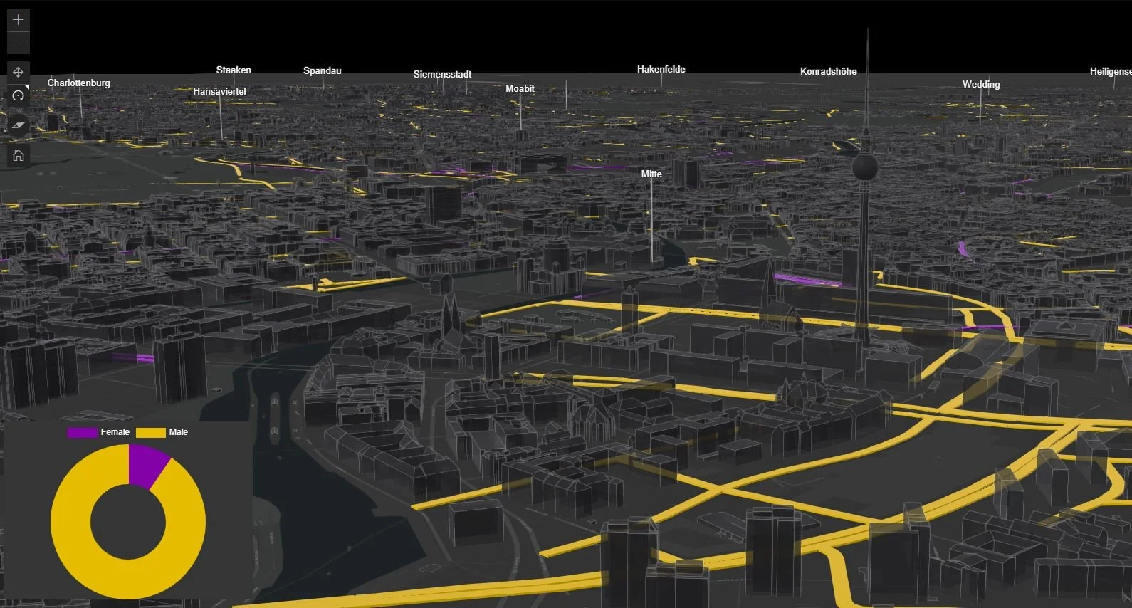
In the Berlin Equal Street Names application, a viewer can explore the streets on an interactive 3D map of Berlin, as well as on a chart that updates when navigating on the map. The data on street names related to gender shows that 87,5% of streets in Berlin are named after men.
Additional elements have been added to help with navigation such as 3D labels displaying the names of districts.
This sample application was used in a 1-day coding workshop to teach the fundamentals about creating performant 3D web apps with the ArcGIS Maps SDK for JavaScript using modern web technologies (TypeScript, ESM module, bundlers, etc.).
The displayed data layers that are consumed by the application are hosted as feature services and scene services on ArcGIS Online. The equal street names data is open-source as well as the Berlin buildings and trees.
Even though the project was primarily used to teach coding patterns and best practices, the topic and data can also inspire a different perspective on how our cities have been designed and built.
Imagine you are walking through the streets of Berlin as a woman - beyond the fact that many elements of the city weren’t designed with the female perspective in mind - the fact that most streets are named after famous men will not increase the feeling of belonging and inclusion.